Towra Point - Human Activity
Historic birth, modern death
Plan to turn back Botany's tide of neglect
Dictionary of Sydney - Botany
Sutherland Shire Environment Centre - Issues of Concern
Plan to turn back Botany's tide of neglect
Dictionary of Sydney - Botany
Sutherland Shire Environment Centre - Issues of Concern
|
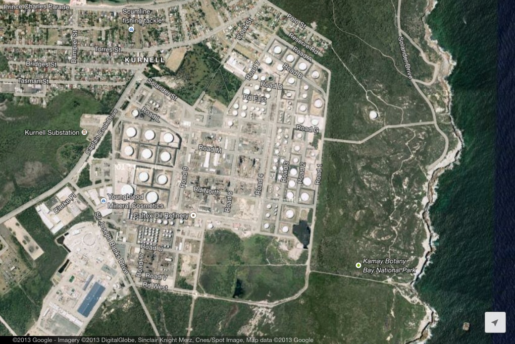
Caltex Oil Refinery
The oil refinery has produced petrol, jet fuel, butane and a range of other products. There is a real risk of tankers spilling oil into the Bay, and this has already happened several times. In 1979 there was a major oil spill in the area which had a width of approximately 3km. This affected 100ha of mangroves. The refinery is also permitted under law to release a range of emissions including groundwater, water pollution and sludge among other things. The refinery has announced it will be closing. A new risk will be the deterioration of the buildings and rehabilitation of the site to remove chemicals. Caltex axes up to 630 jobs with refinery closure The development of the oil refinary over time. Caltex's perspective. Airport
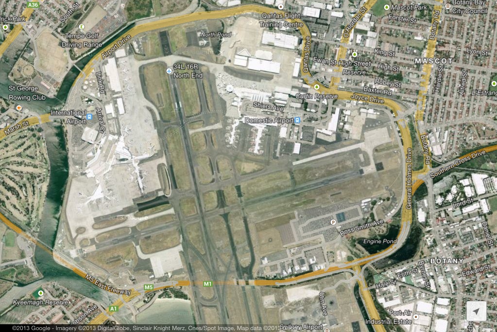
The airport is located opposite Towra Point Wetland on the northern side of Botany Bay. The area consists of a great deal of cement (an impermeable surface), meaning that any runoff will carry with it oils and jet fuel directly into the bay. In addition the noise of the aircraft flying overhead disturbs the migratory birds that use Towra Point as a breeding ground. The construction and dredging required to create the third runway resulted in a significant decline in the amount a seagrass in Botany Bay. This also resulted in the reclamation of shorebird habitat (such as that for the Little Tern), and resulted in a decline of some migratory birds in Towra Point in the same period. Sediment deposition and the speed of waves have also been affected by the creation of the third runway. Wave refraction off the hard surface of the third runway has increased the speed of water hitting sections of Towra Beach.. Industrial development
A wide range of industrial activities have cause irreversable damage to Botany Bay and Towra Point Wetlands. Historically tanning and wool scouring occured in the area because they were isolated from the original settlement in Port Jackson/ Sydney Harbour. The area was first used as a port in 1880 and sandmining began in the 1930s. In the 40s and 50s Boral and the Australian Oil Refinery began using the bay to transport oil. During the 70s there was extensive dredging and land reclamation around the bay. Sandmining, toxic chemicals discharge and dredging all changed the shapes and chemical composition of the bay. Orica
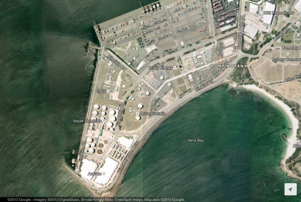
Companies such as Orica have contaminated groundwater and the sands aquifer below the wetlands with chemicals. Orica has also had a similar impact on Homebush Bay Wetlands. EPA - Orica Botany Orica charged over mercury vapour release Sydney residents fear Orica Contamination Econews - Orica articles 177 breaches of pollution licence at Orica's facility near Botany Bay |
|
|
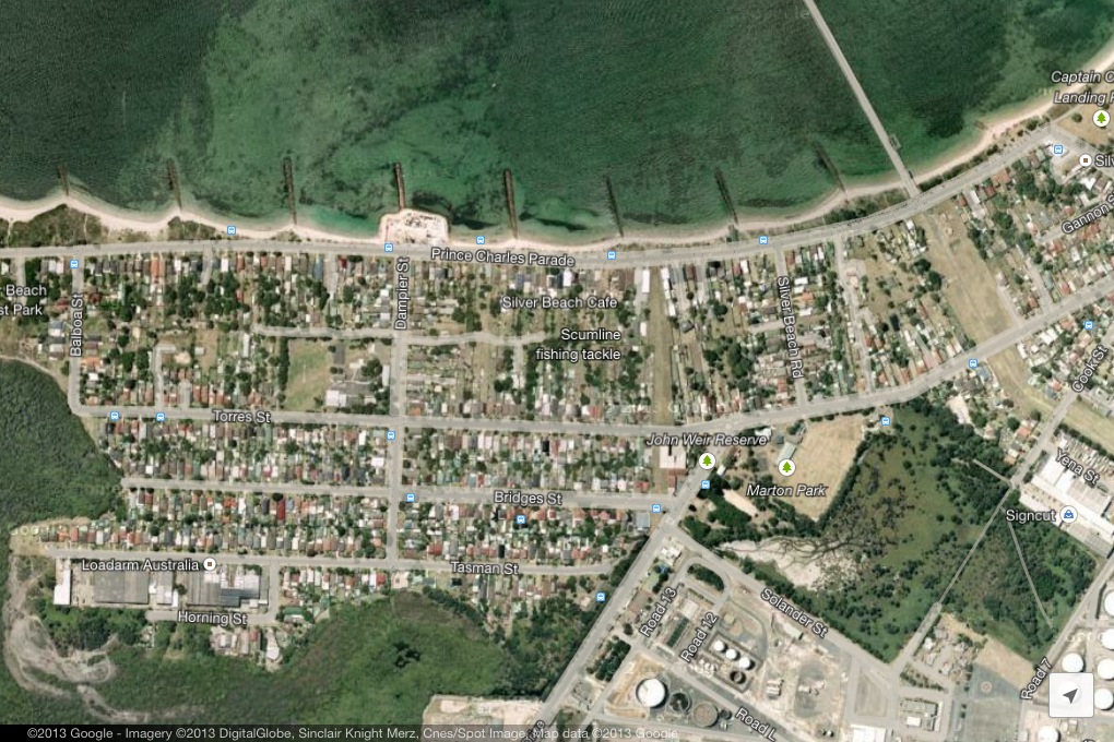
Residential development
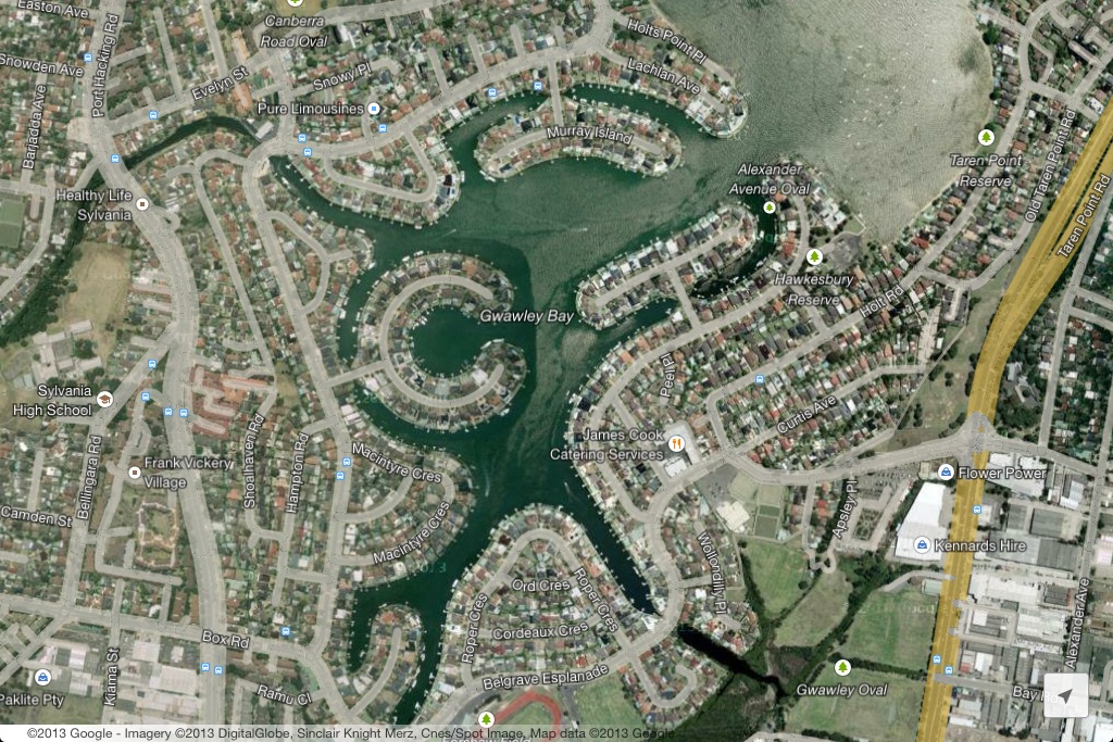
Residential areas reduce the areas available for natural vegetation, change natural water flow and increase local population pressure. Ornamental gardens in yards also provide a threat as invasive weeds can escape from gardens and compete with native vegetation. Groynes These artificially constructed sea walls trap sand being carried inland by the waves. Most of these sea walls were constructed during the 1960s and 70s and were a response to beach erosion along Silver Beach.This is particularly an issue as Towra Beach is eroding and this cuts off a source of sand to replenish sand on Towra Beach. Creeks and stormwater Stormwater run-off from residential areas can contain fertilisers, pesticides, oils and chemicals such as paint, etc. This run-off enters the bay and can impact on the floral and faunal aquatic species living there. It can change the pH of the water (acidity and alkalinty). Fertilisers can result in an increase of phosphorous in the water and cause algal blooms. Oils and chemicals can smother aquatic plants and animals. This makes it difficult for plants to photosynthesise and can make it difficult for birds to fly and frogs (and other amphibians) to breathe. Canal developments Waterfront canal housing developments like Sylania Waters clear wetlands, change river banks to hard impermeable surfaces, and increase population pressure close to the river and bay. Desalination Plant Construction report |
|
Golf courses and recreational parkland
Golf courses and other forms of recreational parkland create somewhat of a buffer between the bay and residential and industrial land uses. However, these land uses involve the clearing of natural vegetation resulting in increased run-off (compared to natural vegetation) and reduced habitat areas. 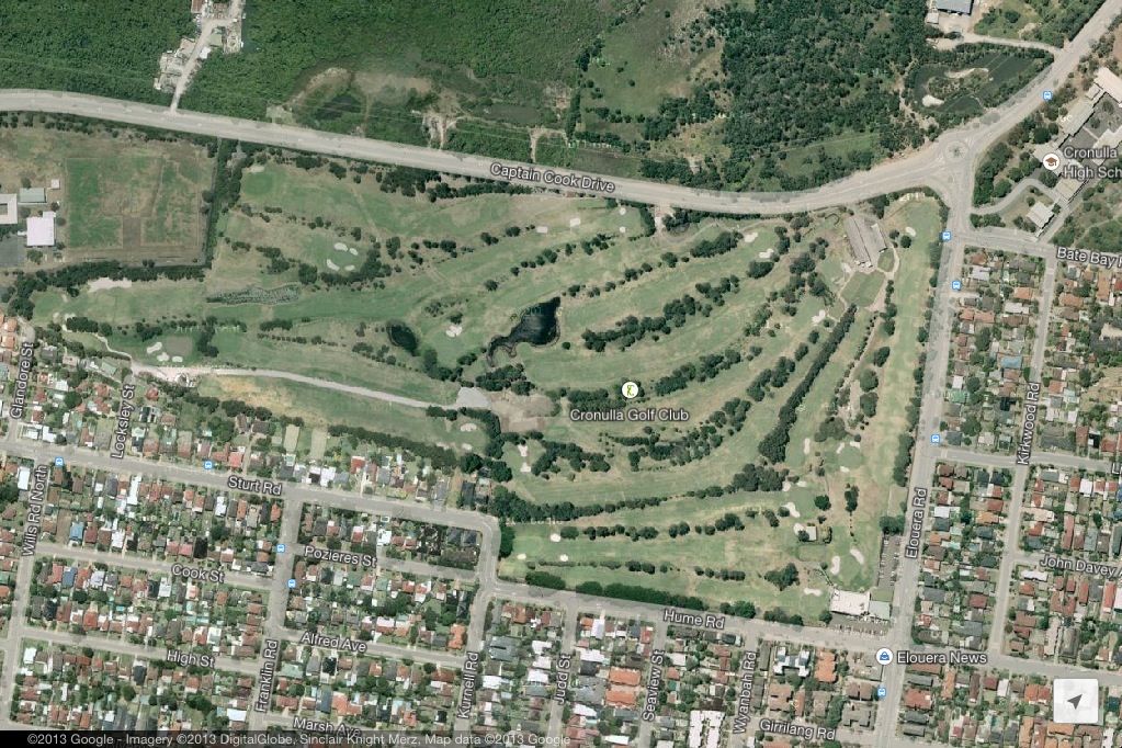
|
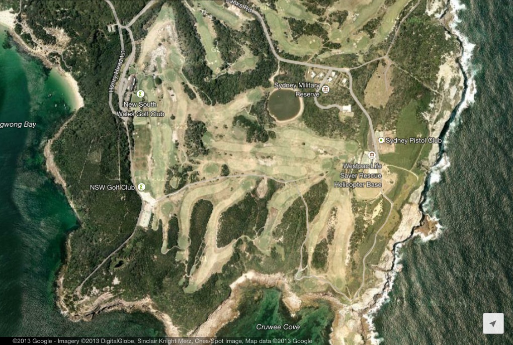
Natural vegetation is replaced by grasses such as Kikuyu. Efforts to keep the grass green and of a good playable standard result in the use of fertilisers which can flow into the bay or nearby creeks.
|
|
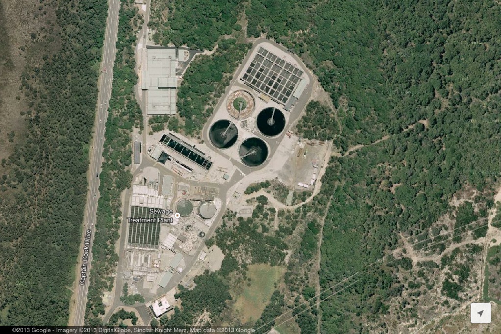
Sewage treatment plant
Sewage overflow in rainy periods can result in untreated sewage entering Botany Bay. This contains high levels of nutrients and can result in algal blooms as a result of eutrophication. The video above examines what happens at a sewage treatment plant. It is not specific to Towra Point.
|
|
|
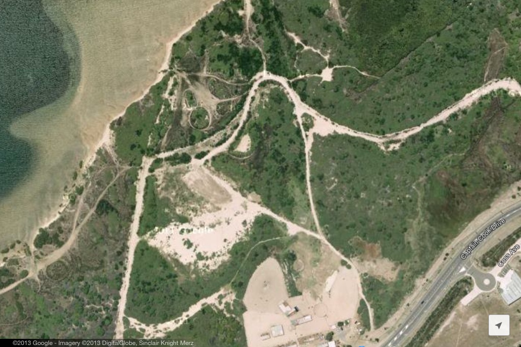
Pathways and pathway erosion
Pedestrian movement in and around the Reserve creates pathways avenues of erosion. Pedestrians who don't stay on the pathway will trample and kill plants, making the pathway wider. |
|
|
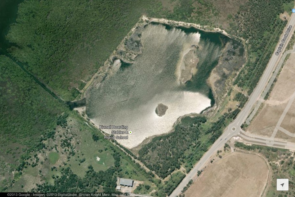
Horse stables
Nearby Horse stables provide a risk of horses trampling on vegetation as they walk through the surrounding area. It is possible that their droppings may contain duttings or seeds of invasive plants. |
|
|
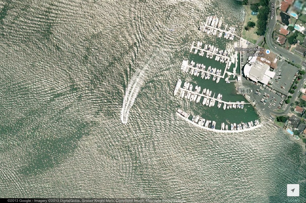
Boating
The use of recreational boats in the bay results in damage to aqautic vegetation and increased rates of erosion. The propellers on boats chop up sea grass in shallow water. This can have a long-lasting impact as seagrass take a long time to recover from disturbances. High spedd boats and sea craft such as jet skis create wash (waves caused by the boat) which causes erosion along the beaches. |
|
Future Developments
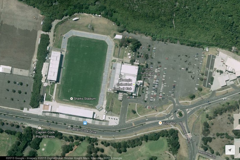
Cronulla Sharks A $330 million, 600 unit development by the Sharks Leagues Club will introduce a range of threats to Towra Point. Concerned residents raised over 2000 concerns about the development. The site is only 35m back from the edge of the wetlands. This will intensify the impacts of residential developments such as stormwater and impermeable surfaces. The close proximity of the development will also impede the capacity of the wetlands to move landward if the sea levels rise. Greenhills development |
| towra_point_human_impacts.docx |
